
Nonnav · Updated August 23, 2026 · Estimated read time: 9 minutes
Key Takeaways
- The GNSS antenna finds the machine in space; the IMU sensors measure how the boom, arm, and bucket are angled. Neither works alone, and together they compute the bucket tip position to ±2-3cm.
- A single-antenna system without IMU sensors cannot hold accuracy during cab rotation or on slopes, which is exactly where excavators work. The IMU layer is what separates ±3cm guidance from ±10cm-class.
- When buying or troubleshooting a guidance system, the configuration list matters more than the brand: how many antennas, whether IMU sensors sit on all three linkages, and whether the kit is wireless.
±2-3cm
Dual Antenna + IMU
2
Antennas for Heading
3
Linkages with IMU
±8-12cm
Single Antenna, No IMU
The Two Components That Answer One Question
Every excavator guidance system answers the same question: where is the bucket tip, and how far is it from where it should be? The GNSS antenna and the IMU sensor answer two halves of that question, and the system fuses their answers into one position.
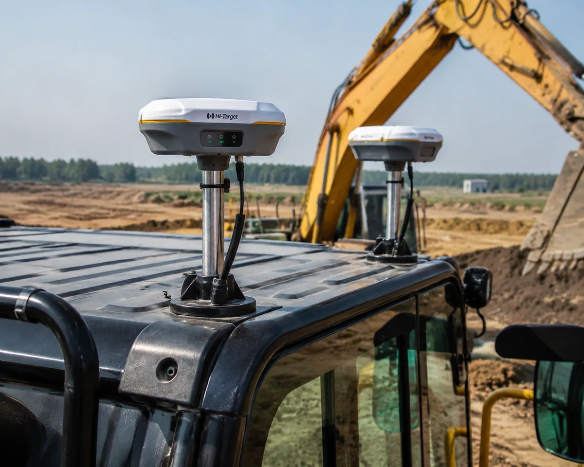
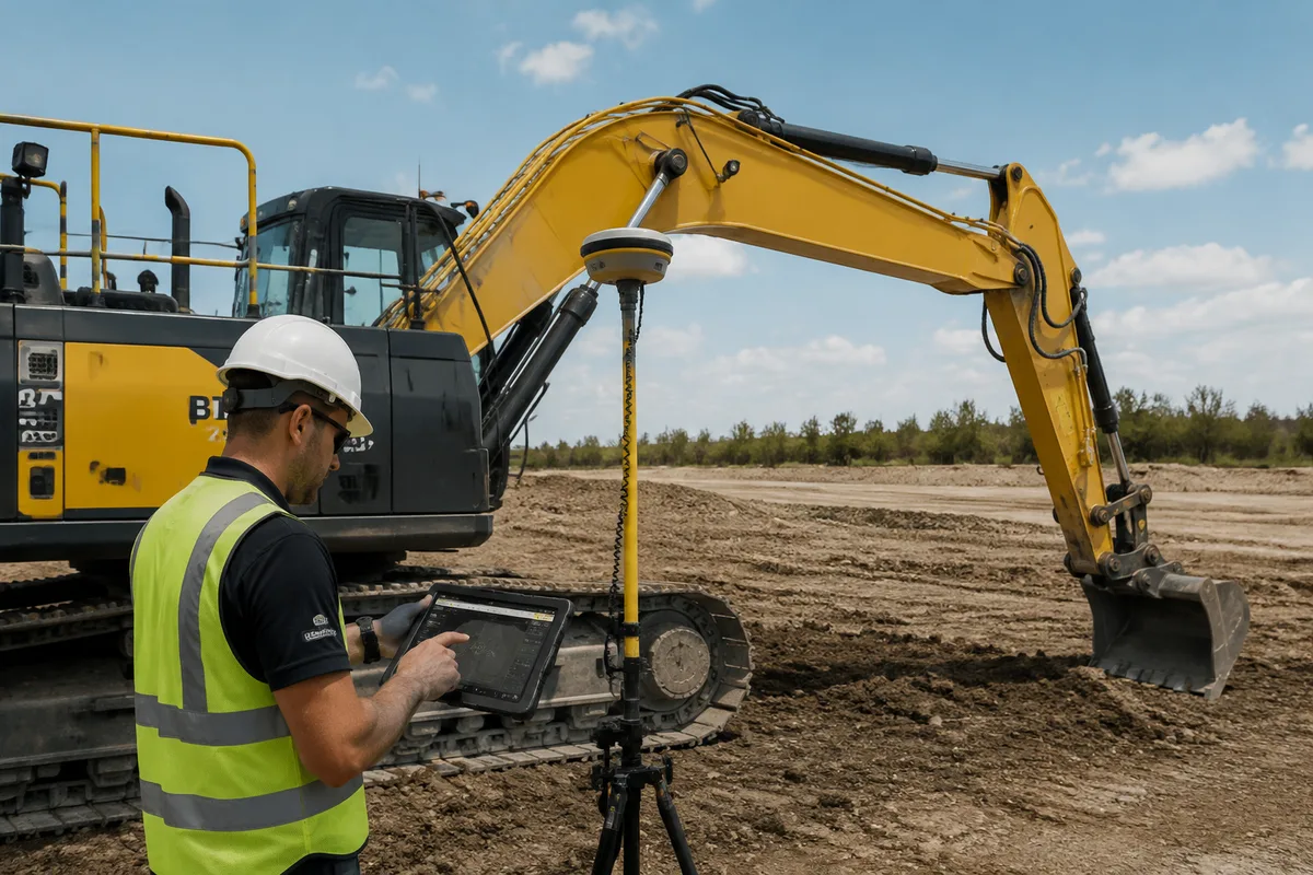
The GNSS antenna answers “where is the machine?” It receives satellite signals and, with RTK corrections, fixes the antenna’s position to ±2-3cm in global coordinates.
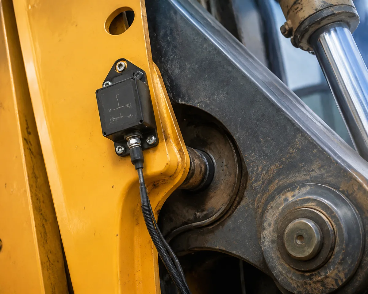
The IMU sensors answer “how is the machine bent?” Mounted on the boom, arm, and bucket linkages, they measure the angle of every joint in real time. Combined with the known lengths of the linkages, that tells the system where the bucket tip is relative to the antenna.
Neither half means much alone. A GNSS antenna without IMU data knows where the cab is, but not where the bucket is. IMU sensors without GNSS know the machine’s shape, but not its position. The system needs both.
What the GNSS Antenna Actually Does
The antenna is the machine’s eye on the sky. It picks up signals from GPS, GLONASS, Galileo, and BeiDou satellites, and its job is to turn those signals into a position fix.
Single-antenna systems fix the position of one point on the machine, usually the cab roof. They know where that point is, but cannot tell the machine’s heading or its attitude on slopes without extra help.
Dual-antenna systems fix two points, which gives the system the machine’s heading and orientation. This is the setup that holds ±2-3cm during full cab rotation.
RTK corrections are what turn raw satellite data into centimeter-level accuracy. Without a base station or network correction source, the antenna’s fix degrades to meters. The antenna does not care about the bucket. It only knows where its own location is. Everything between the antenna and the bucket tip is the IMU sensors’ job.
What the IMU Sensors Actually Do
IMU stands for Inertial Measurement Unit. Each sensor contains accelerometers and gyroscopes that measure acceleration and rotation, which lets the system track the angle of the linkage it is mounted on.
Boom angle: the angle of the main boom relative to the machine body. Arm angle: the angle of the stick relative to the boom. Bucket angle: the angle of the bucket relative to the arm. Machine attitude: pitch, roll, and heading of the machine body itself.
With the three linkage angles and the machine’s attitude, the system calculates where the bucket tip sits in space relative to the antenna, using the known dimensions of the boom, arm, and bucket that you entered during calibration.
Why it matters on an excavator: an excavator works by rotating the cab, lifting the boom, curling the arm, and tilting the bucket. Every one of those movements changes the bucket position. A system without IMU sensors on the linkages cannot track those changes, so accuracy collapses the moment the machine moves.
How the Two Work Together: The Data Flow
- The GNSS antenna fixes the antenna position in global coordinates (with RTK corrections, ±2-3cm).
- The IMU sensors on the boom, arm, and bucket measure every joint angle in real time.
- The receiver combines the antenna position with the IMU angles and the calibrated linkage dimensions.
- The system calculates the bucket tip position in 3D space.
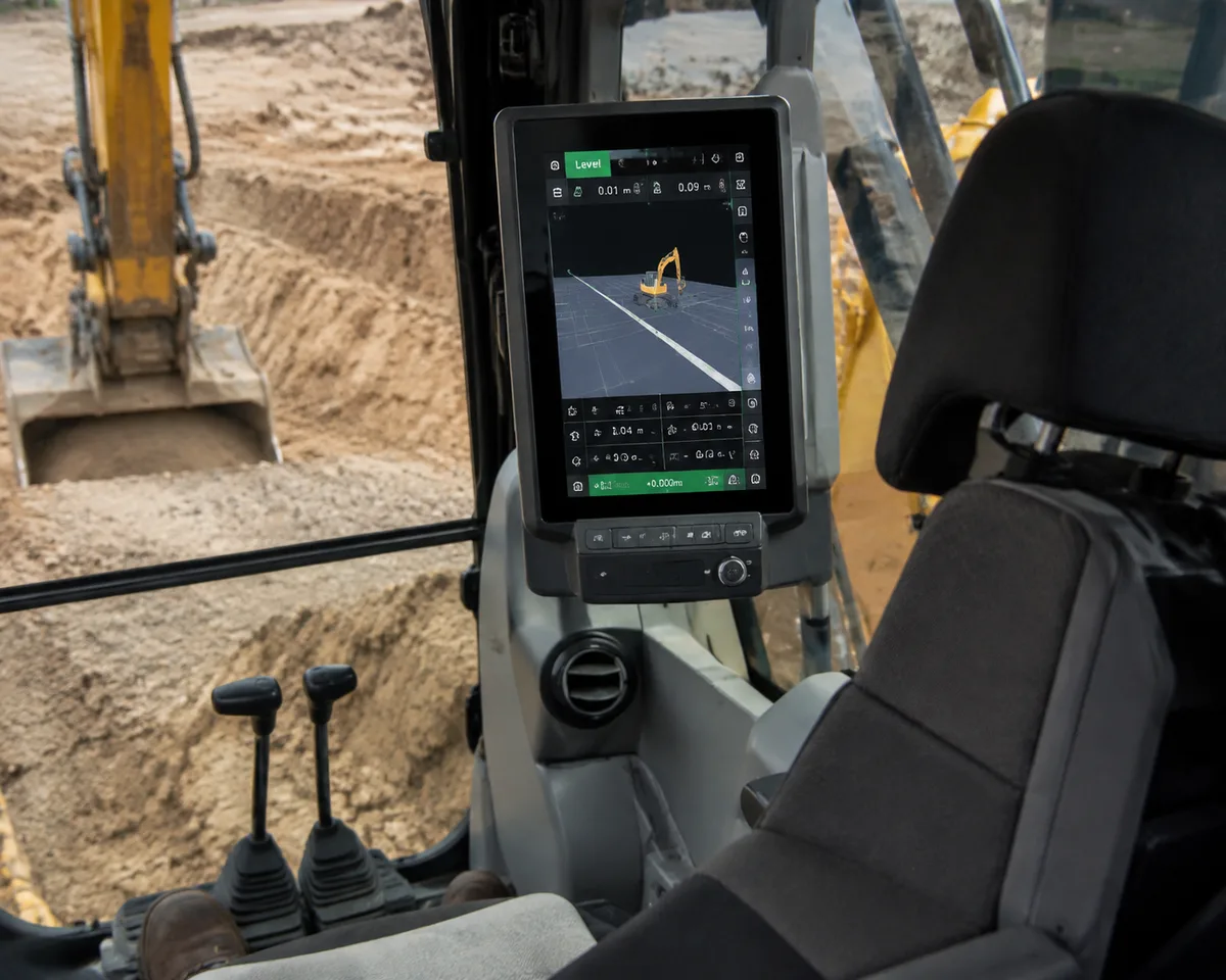
- The in-cab display compares that position against the design surface and shows cut/fill guidance.
- The operator follows the display: dig deeper, stop, slope left.
The magic is in the fusion. The antenna answers “where,” the IMU answers “how bent,” and the math in between turns both into a bucket position the operator can trust.
Single Antenna vs. Dual Antenna vs. IMU: What the Configuration Means
| Configuration | What it knows | Flat work | Rotation / slopes | Best for |
|---|---|---|---|---|
| Single antenna, no IMU | Machine position only | ±8-12cm | Unreliable | Simple depth/slope, ±10cm work |
| Single antenna + IMU | Position + linkage angles | ±3-5cm | Degrades without heading | Moderate-tolerance grading |
| Dual antenna + IMU | Position + heading + linkage angles | ±2-3cm | Holds ±3cm | Structures, utilities, finished grade |
The table explains the price gap between guidance tiers. The dual-antenna + IMU configuration costs more because it answers the hardest question: where is the bucket while the machine is spinning and tilting?
How to Tell What Your System Actually Has
1. How many antennas? One antenna means no heading data. Two antennas mean the system knows the machine’s orientation, which is what holds accuracy during cab rotation.
2. Are IMU sensors on all three linkages? Boom, arm, and bucket all need sensors for full 3D accuracy. Some budget systems put sensors on the boom only, which leaves the bucket angle a guess.
3. Is the kit wireless? Wireless kits pair the antennas, sensors, and display without cabling. This matters for rental machines and mixed fleets, where the kit needs to move between machines.
A system that says “GNSS guidance” on the box may be any of these configurations. Read the list, not the headline.
A single-antenna system without IMU sensors is not suitable for structures, utilities, or finished grade with ±3cm contract tolerances. It also is not the right fit for steep slopes or confined sites where satellite visibility is poor. Match the configuration to the work, not the other way around.
Decision Engine: If X → Choose Y
If your contract tolerance is ±3cm or tighter (structures, utilities, finished grade) → choose a dual-antenna + IMU configuration with sensors on all three linkages. Nothing less holds accuracy through rotation and slopes.
If your work is ±10cm bulk earthworks and mass grading → a single-antenna system without IMU is sufficient and costs half. The IMU premium buys accuracy you will not use.
If your machine rotates the cab constantly while digging → dual antennas are non-negotiable; heading data is what holds position during rotation.
If you rent machines or switch jobsites often → choose a wireless kit that transfers between machines; the configuration list stays the same, but installation time drops to 20-30 minutes.
If you are troubleshooting an accuracy drop → verify the antenna fix quality first, then the IMU readings on all three linkages, then calibration. The fault is usually in one of those three.
How to Verify the Components Are Working
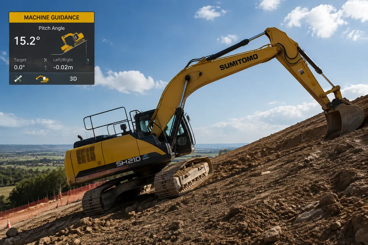
Check the antenna signal. The display should show the number of satellites and the RTK fix quality. If the fix indicator drops out, the antenna is losing signal from tree cover, deep cuts, or a failed correction source.
Check the IMU readings. With the machine parked and level, the display should show zero angle on all linkages. Swing the machine 360 degrees and confirm the heading readout tracks the rotation. If a linkage reads a constant offset, that sensor needs recalibration.
Dig a test trench and survey it. This is the ground truth. Compare the in-cab reading against a survey check of the same surface. If they disagree by more than the rated accuracy, something in the chain, antenna, IMU, or calibration, is off.
Conclusion
The GNSS antenna and the IMU sensors are not competing components; they are two halves of one position calculation. The antenna finds the machine in space, the IMU sensors track the bucket through every boom, arm, and bucket movement, and the receiver fuses both into a position the operator can trust.
When you buy a guidance system, read the configuration list, not the brand name. Count the antennas, check whether IMU sensors sit on all three linkages, and verify the kit fits your machines. Those three numbers decide whether your system holds ±3cm or drifts to ±10cm.
If You Only Remember One Thing
The GNSS antenna finds the machine; the IMU sensors track the bucket. A system needs both, and the configuration that holds ±3cm through rotation and slopes is dual-antenna + IMU on all three linkages. Read the configuration list before you buy.
Get a Custom Quote
Tell us your fleet size and the job types you run, and we will send pricing for the configuration that fits your contract tolerances.
Frequently Asked Questions
References & External Resources
Manufacturer documentation on machine control technology
GNSS manufacturer perspective on system selection
Machine control manufacturer product documentation
GNSS antenna and receiver manufacturer technical documentation
Practical contractor guide to machine control adoption
Operator training provider guide to guidance systems