
Nonnav · Updated August 22, 2026 · Estimated read time: 12 minutes
Key Takeaways
- Excavator machine guidance uses GNSS satellites, IMU sensors, and in-cab displays to show operators exactly where the bucket is in 3D space, eliminating grade stakes and surveyors.
- Contractors typically see 30-50% productivity gains, 40% reduction in over-excavation, and ROI measured in months, not years.
- If your project requires ±3cm tolerance or tighter, machine guidance is no longer optional. It is the baseline for competitive bidding.
+30-50%
Productivity Gain
-40%
Over-Excavation
±2-3cm
RTK Accuracy
20-30 min
Wireless Install
What Is Excavator Machine Guidance?
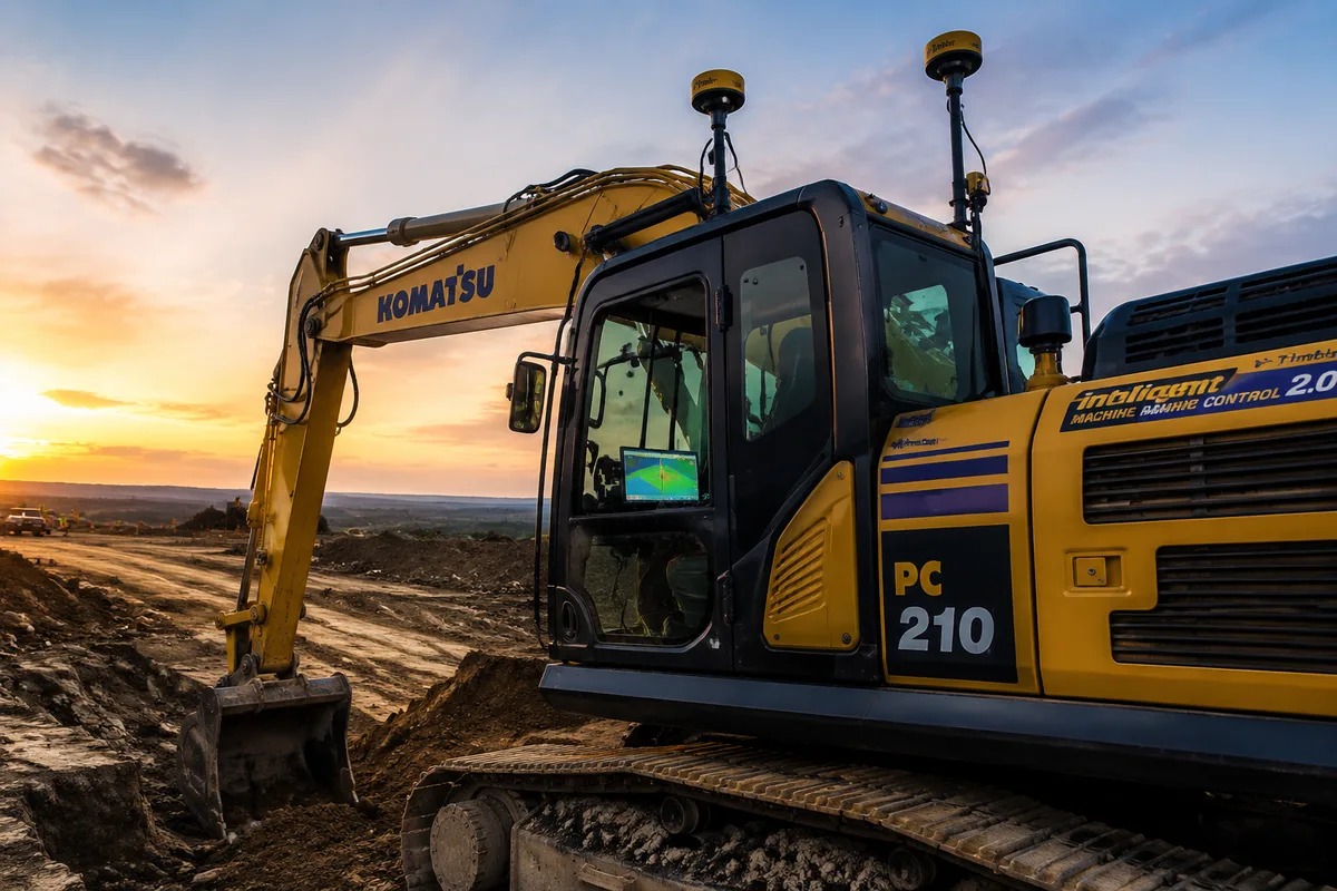
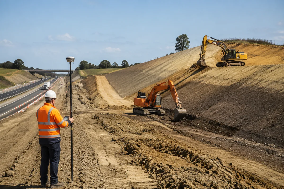
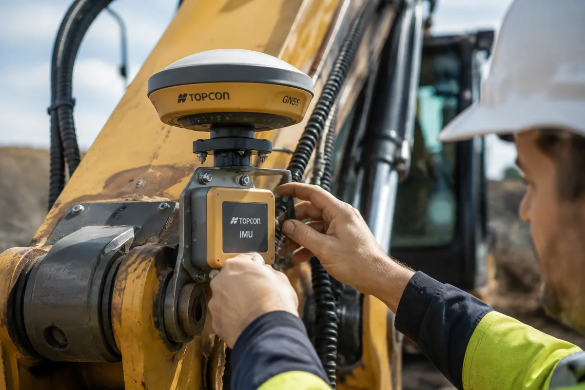
Excavator machine guidance (also called GPS excavator guidance, 3D machine control, or GNSS excavator guidance) tells the operator where the bucket teeth are in three-dimensional space, in real time, against a digital design model of the finished surface.
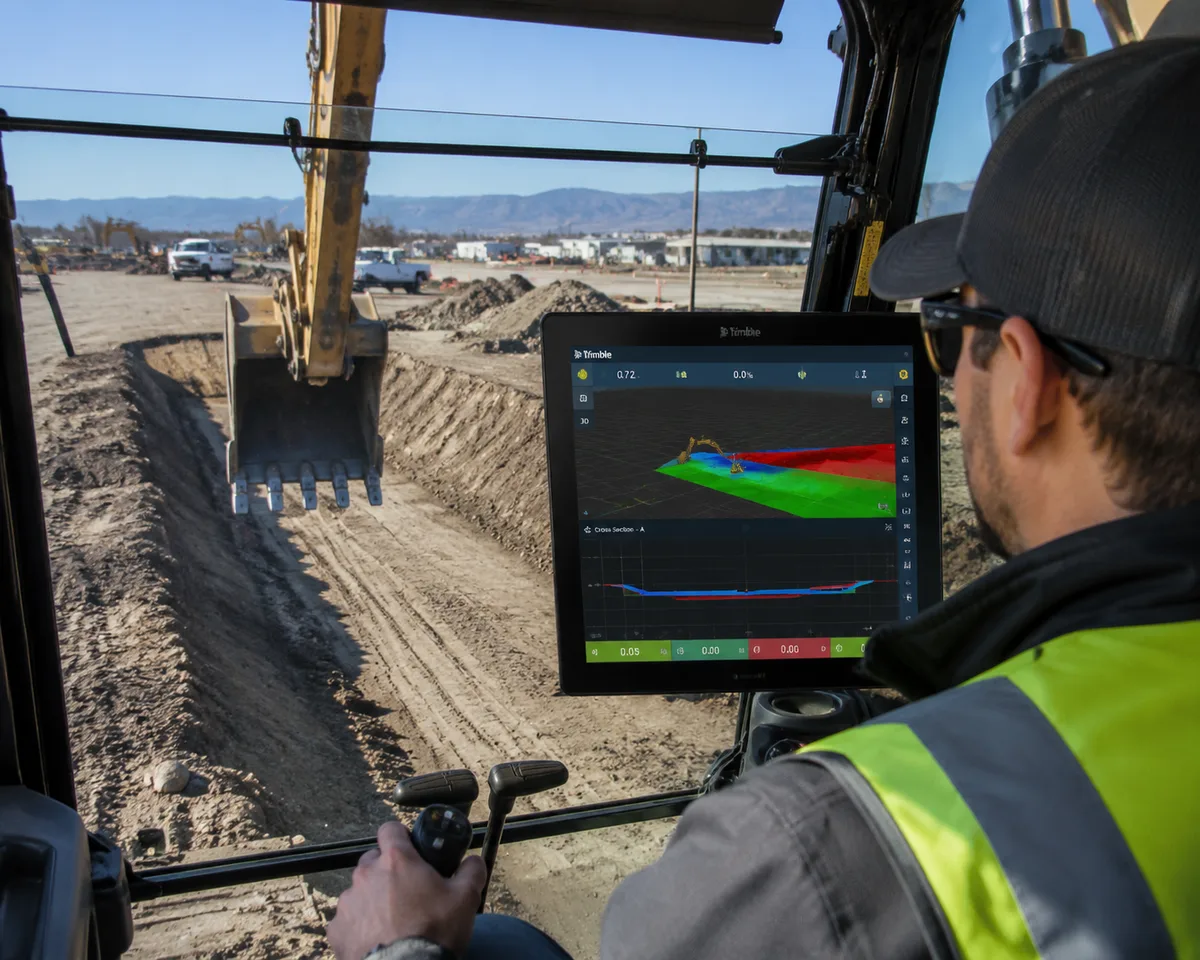
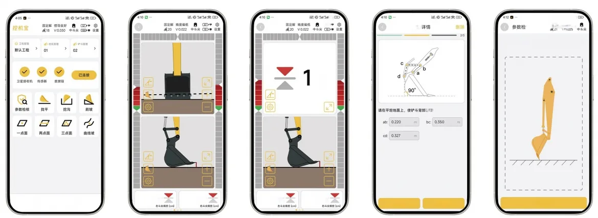
Instead of wooden grade stakes, paper plans, or a surveyor shouting from the trench edge, the operator watches a live cross-section inside the cab. The screen shows how deep to dig, where to stop, and whether the slope matches the design, without stopping the machine.
Core Components
| Component | Function | Location |
|---|---|---|
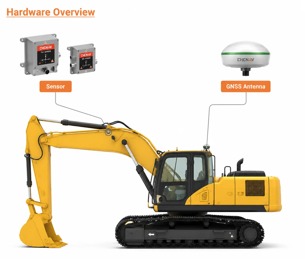
| GNSS Antennas (1-2) | Receive satellite signals from GPS, GLONASS, Galileo, BeiDou | Top of cab or boom |
| IMU Sensors | Track machine pitch, roll, heading during movement | Boom, arm, bucket linkages |
| Receivers | Process RTK corrections for centimeter accuracy | Inside cab or antenna housing |
| In-Cab Display | Shows real-time bucket position vs. design model | Dashboard-mounted |
| Design Files | 3D digital terrain model of the finished surface | Loaded via USB or cloud |
How the Data Flows
- Satellites broadcast positioning signals to the machine’s GNSS antennas.
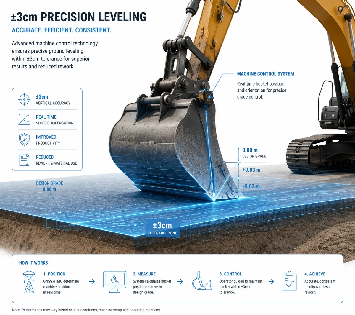
- The receiver applies RTK corrections from a base station or network (NTRIP), removing atmospheric errors to bring accuracy to ±2-3cm.
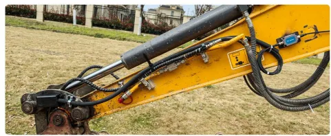
- IMU sensors on the boom, arm, and bucket measure every angle, calculating the exact bucket tooth position relative to the machine body.
- The system fuses satellite position + IMU angles to determine bucket tip location in 3D space.
- The in-cab display compares this live position against the design surface and shows cut/fill guidance.
- The operator follows the visual cues (dig deeper, stop, slope left) to match the design.
A real one: On a highway embankment project in Hubei, China, a 20-ton excavator with a Nonnav dual-antenna system held ±3cm for an entire 8-hour shift. No grade checks. The operator said he got through work that used to take two machines.
Machine Guidance vs. Traditional Methods
| Dimension | Traditional (Stakes + Checker) | Machine Guidance |
|---|---|---|
| Setup time | 2-4 hours for survey + stakes | 20-30 minutes (wireless) |
| Grade checking | Continuous (surveyor follows machine) | Zero (real-time guidance) |
| Accuracy consistency | Operator-dependent, drifts over shift | Consistent ±2-3cm all shift |
| Rework rate | 10-15% of excavated volume | <3% of excavated volume |
| Night operation | Impossible without lighting + surveyor | Full capability (self-lit display) |
| Crew size | 2-3 (operator + checker + surveyor) | 1 (operator only) |
| Learning curve | Years to become proficient | Days to become productive |
KEY DATA POINT
A 2024 Construction Industry Institute study found machines running guidance 60%+ of operating hours were the only ones to pay back in under 12 months.
NOT SUITABLE WHEN
One-off tiny digs, machines older than 15 years without hydraulic auxiliary ports, or sites where the design changes hourly without model updates.
Types of Excavator Guidance Systems
2D Guidance (Depth + Slope): Measures depth and slope along a single plane. Best for simple trenching, foundation footings, basic grading.
3D GNSS Guidance (Full Surface Model): Loads the complete DTM into the cab with plan and cross-section views. Best for highway, drainage, subdivision earthworks.
3D GNSS + IMU (Full Automatic): Adds IMU sensors to every linkage. Maintains bucket position during rotation, cab tilt, and ground shift. Most consistent ±3cm accuracy.
When to Choose Which System
| If you… | Choose |
|---|---|
| Dig repetitive trenches with consistent depth | 2D guidance (lowest cost) |
| Work on complex grading with digital models | 3D GNSS guidance |
| Operate in challenging terrain with steep slopes | 3D GNSS + IMU |
| Need wireless installation on rental/multiple machines | 3D GNSS + IMU (e.g., Nonnav system) |
How to Implement Machine Guidance on Your Site
Step 1: Assess your fleet. Start with the machine that does the most precision work: final grade, sloping, trenching. Occasional-use machines should stay traditional.
Step 2: Choose your RTK correction source. Dedicated base station (full control, no recurring fees) vs. Network RTK/NTRIP (no base station, subscription) vs. both for redundancy.
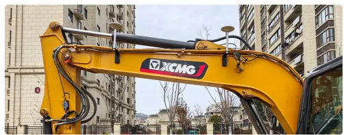
Step 3: Install and calibrate. Modern wireless systems like Nonnav require no cabling between roof antennas and display. Installation takes about 20 minutes. Calibration: enter boom/arm/bucket dimensions, perform a full 360° swing calibration, then dig three test trenches against a survey check.
Step 4: Train the operator. Most operators reach 80% proficiency within 3-4 shifts. Key points: reading the display color coding (red = above grade, green = at grade, blue = below), trusting the numbers, and catching lost RTK correction immediately.
ROI Estimate for Machine Guidance
| Factor | Conservative | Aggressive |
|---|---|---|
| Productivity gain | +25% | +50% |
| Over-excavation reduction | -20% | -40% |
| Grade checker cost eliminated | $3,000-5,000/mo | $5,000-8,000/mo |
| Fuel savings | -10% | -20% |
| Machine wear reduction | -5% | -15% |
Example: Machine rate $85/hr × 160 hrs/mo, 30% productivity gain → 48 hrs saved. Plus $4,000/mo grade checker eliminated, $1,500/mo material savings. Total ≈ $9,580/mo saved → payback in 2-3 months.
Decision Engine: Should You Adopt Machine Guidance?
If your contract requires ±3cm or tighter → machine guidance is non-negotiable; it’s the baseline for competitive bidding.
If you run 160+ machine hours/month on precision work → payback is typically 2-4 months; adopt now.
If you grade only 1-2 days per month → keep stakes; the technology won’t pay for itself.
If you rent machines or switch jobsites often → choose a wireless system that transfers between machines.
Conclusion
Excavator machine guidance has moved from a premium add-on to an operational baseline for any contractor working on competitive, precision-driven job sites. The technology eliminates grade checkers, cuts over-excavation by 20-40%, and improves productivity by 30-50%. Wireless systems that install in 20 minutes and retrofit to most modern excavators have made it practical for most contractors to adopt.
Contractors who adopted it now hold grade on the first pass without a surveyor on site. Those who have not are still paying for grade checkers and rework.
If You Only Remember One Thing
The contractor who digs to ±3cm on the first pass, with no grade checker and no rework, will win every bid against the contractor who still chases stakes.
Frequently Asked Questions
References & External Resources
Industry research on machine control technology impact on earthwork productivity
Manufacturer documentation on 3D machine control systems
Industry blog on 3D excavator guidance technology
Practical contractor guide to machine control adoption
GNSS manufacturer perspective on machine guidance selection
Operator training provider guide to 3D GPS systems